ANDORRA
Principality of Andorra
Principat d'Andorra
Motto: "Virtus Unita Fortior" (Latin)
"Strength United is Stronger"
Anthem: El Gran Carlemany, Mon Pare (Catalan)
The Great Charlemagne, my Fath
Location of Andorra (green)in Europe (dark grey) — [Legend]
Capital
(and largest city) Andorra la Vella
42°30′N 1°31′E
For 715 years, from 1278 to 1993, Andorrans lived under a unique co-principality, ruled by French and Spanish leaders (from 1607 onward, the French chief of state and the Spanish bishop of Seu d'Urgell). In 1993, this feudal system was modified with the titular heads of state retained, but the government transformed into a parliamentary democracy. For decades Andorra enjoyed its status as a small refuge of fiscal and banking freedom and benefitted from Spanish and French tourists attracted to the country's duty-free shopping. The situation has changed in recent years as Andorra started to tax foreign investment and other sectors. Tourism accounts for over 80% of Andorra's gross domestic product.
The year 1993, Andorra lived a great moment, approving the "Constitution", and the entry in the United Nations, and all their entities. The representative of the Principate, raises the catalan language to the highest European institutions, using this language (official language of Andorra) in his speech at the U. N.
Nowadays, Andorra, under the government of the "Molt Honorable Sr. Marc Forné i Molné", consolidates as a great touristic and commercial center, as well as in the practice of winter and mountain sports, as well as an incomparable place to enjoy some days with its thermoludic complex "Caldea".
Topographic map of Andorra.
Total Area: 468 sq km (100% land).
Total Land Boundaries: 120.3 km.
Total Coastline: 0 km (landlocked).
Climate: Temperate; snowy, cold winters and warm, dry summers.
Terrain: Rugged mountains dissected by narrow valleys.
Elevation Extremes: Riu Runer 840 m (lowest point).
Pic de Coma Pedrosa 2,946 m (highest point).
Natural Resources: Hydropower, mineral water, timber, iron ore, lead.
Land Use: Arable land ---- 2.13%. Permanent Crops ---- 0.00%. Other ---- 97.87%.
Natural Hazards: Avalanches.
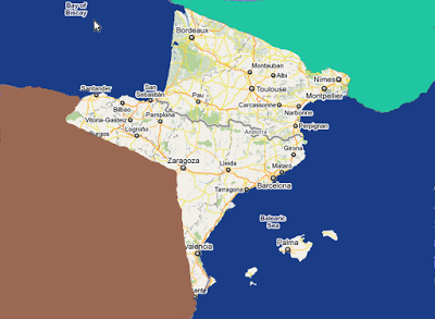
Geography Note: Landlocked; straddles a number of important crossroads in The Pyrenees.
Map of Andorra with its seven parrishes labeled.
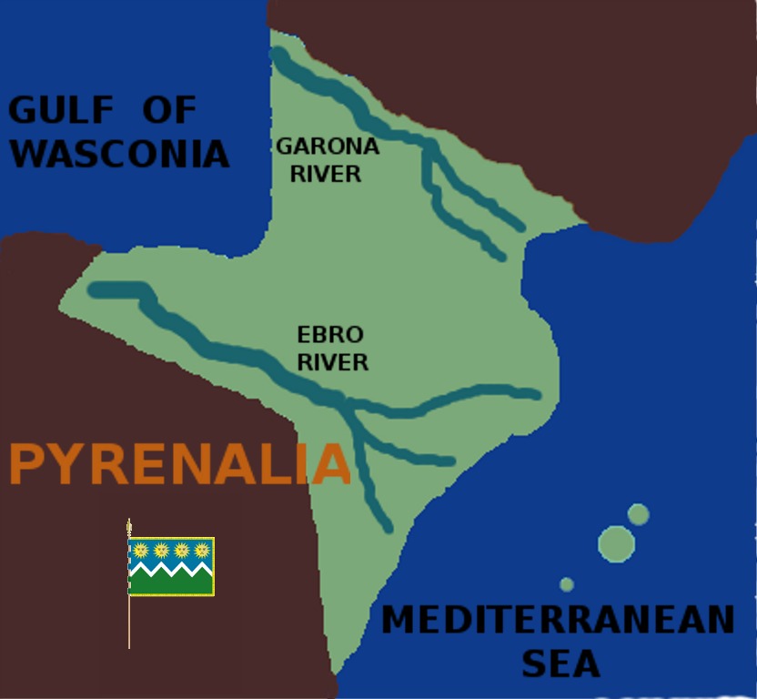
PYRENEAN ISTHMUS AND PERIPHERIA In this blog we are going to try to bring you any kind of useful information that has happened and is happening all along The Pyrenean Isthmus and peripheria, from ocean to ocean and from river to river. We hope you find it useful and enjoyable. And at the same time, we invite you to send us any information related to the subject in any language to be translated into English, by our staff. The address to contact us is: subolospirineos@gmail.com
PYRENEAN ISTHMUS AND PERIPHERIA
No comments:
Post a Comment